Here are some pictures from our last stop in South America. It has been over two months since we got back from Costa Rica, but getting settled in Switzerland has kept us pretty busy.
We entered Costa Rica from Panama. The border crossing was a lot less trouble as some other people suggested it might be. We went relatively quickly from Boquete (Panama) via Golfito and a little private boat over the Golfo Dulce to Puerto Jimenez.
This town is on the Osa Peninsula and is the gateway to the beautiful Corcovado National Park.
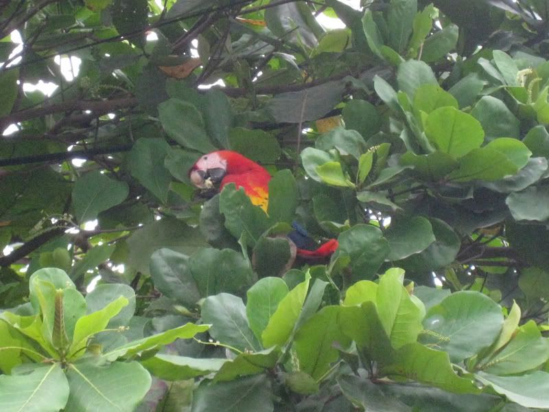
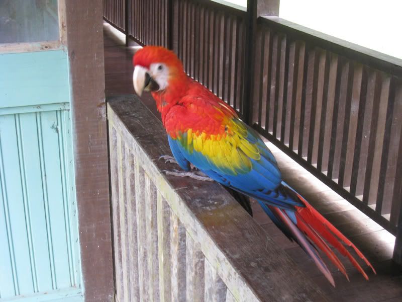
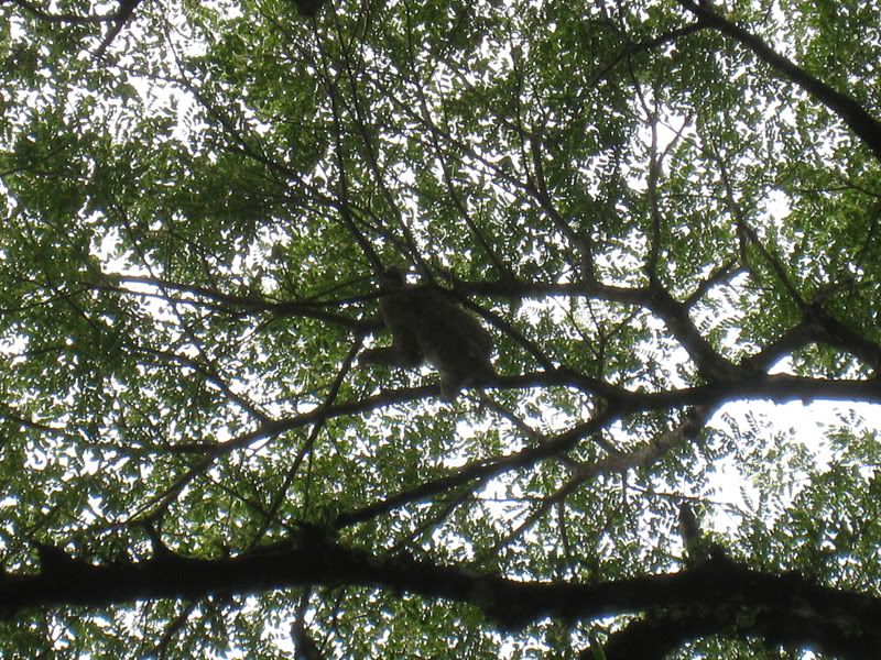
Before we even entered the National Park we saw so much wildlife! This scarlet macaw was just hanging out in the main plaza eating some nuts. There were actually about 10 of them on this one tree!
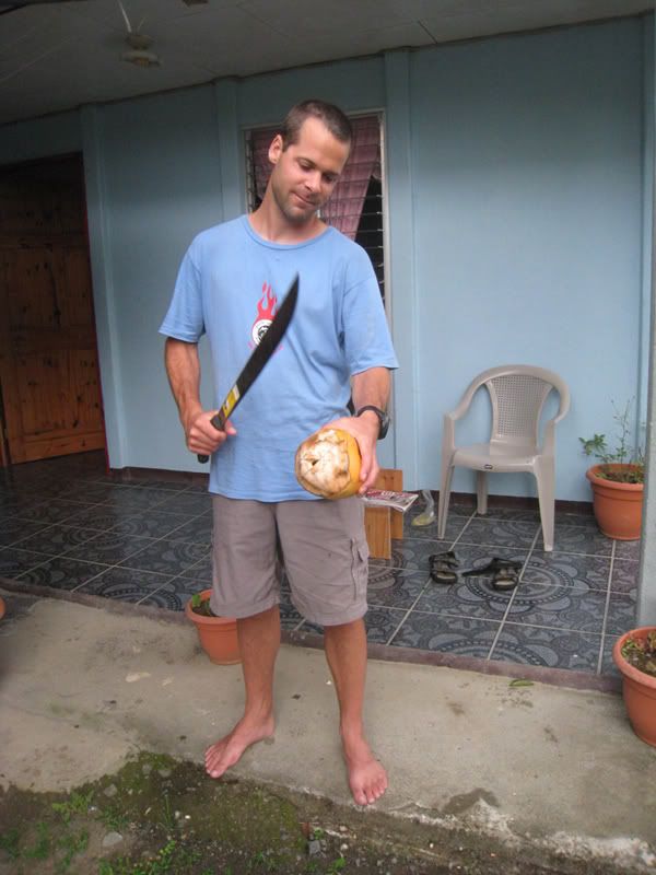
There were also plenty of coconuts! They were everywhere in Puerto Jimenez and very accessible. Oliver found this machete (part of the night attendant’s arsenal of weapons) and put it to good use.
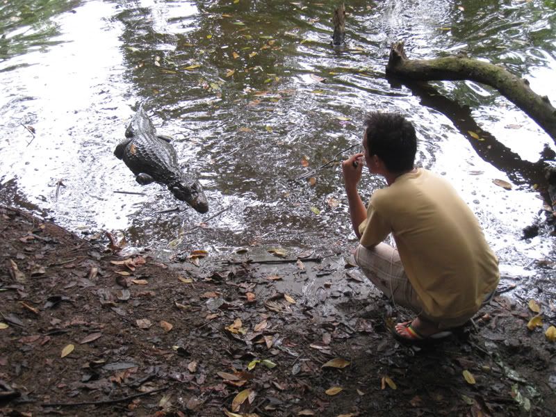
More wildlife within this small town. This caiman just hangs out in the main park just looking for a bite!
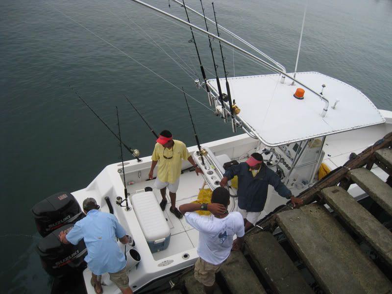
Puerto Jimenez is also popular for sport fishing. This group just came back with their catch.
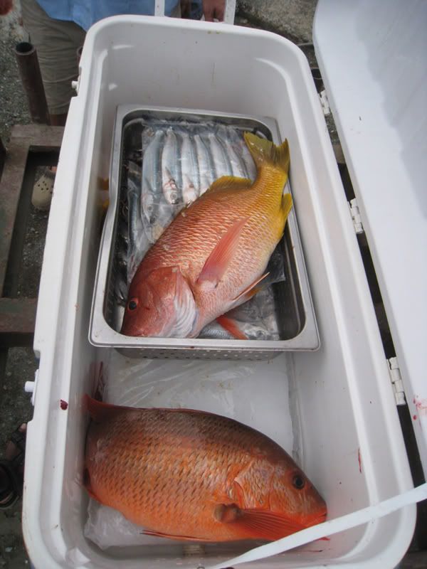
Fresh red snapper!
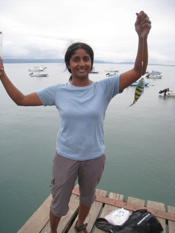
Jaya also tried out her “sport fishing” techniques and caught this cute little fish! You can’t see it well in this picture, but her tool of choice was a plastic bottle that we wrapped with fishing line!
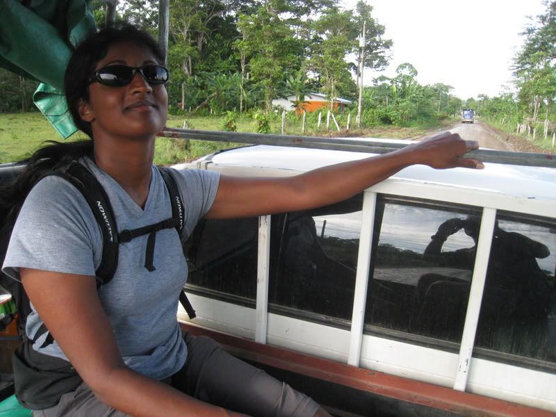
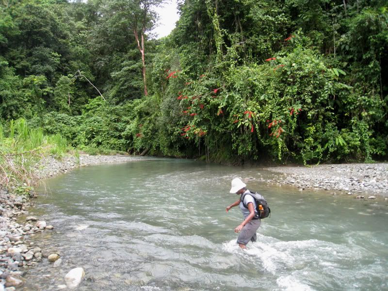
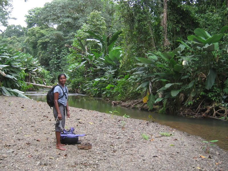
One thing that is unique about Cordova National Park is that it is not very accessible. You have to hike in about 3 hours just to get to the entrance. However, before you start the hike you have to get as close as you can. We hitched a ride on the back of this pickup truck at 6 in the morning. If we didn’t we would have had to walk an additional 2 hours!
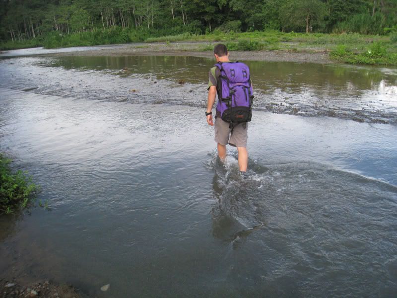
The most fun part of the hike was all the river crossings to the entrance. Jaya counted about 23 crossings. Sometimes the water came well above the knees.
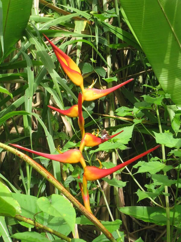
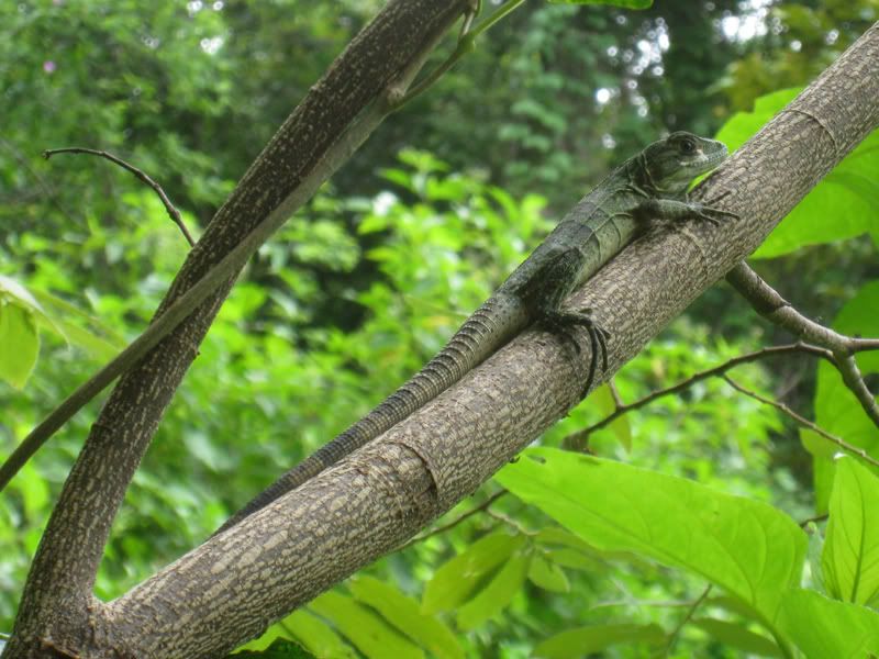
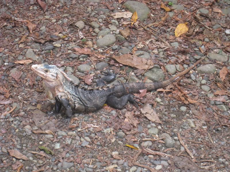
In addition to the varied wildlife, the fauna was also very beautiful.
More river crossings. You pretty much just walked up the river bed and had to cross it about every 5 to 10 minutes. It was a lot of fun!

The water was very swift in some parts.
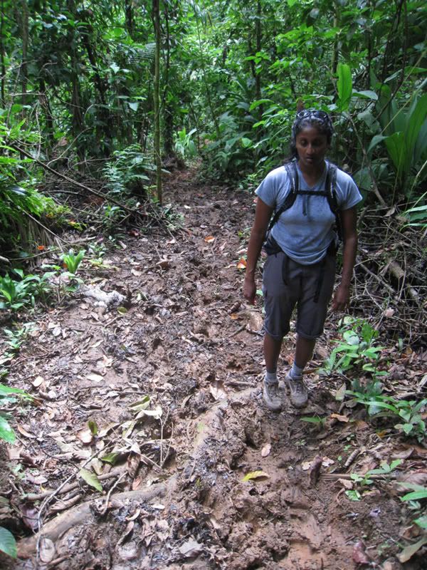
Did I mention that it was rainy season in Costa Rica? Most of the trail looked like this. Here, Jaya is contemplating how to get through the mud without getting completely muddy. By the time we got to the hut, we were covered in mud!
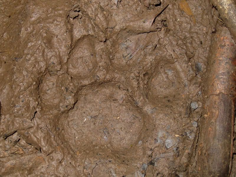
One good thing about the mud was that we saw animal prints clearly. Here is a fresh puma track.
We thought we were done with river crossings, but there were a few more within the jungle.
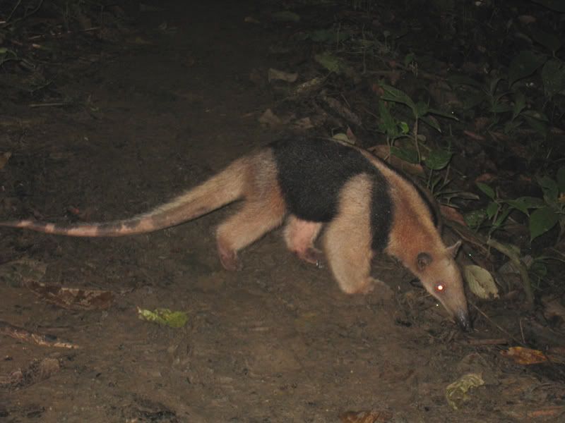
This anteater was on a mission. He barely paid attention to us and crossed only 2 meters in front of us.
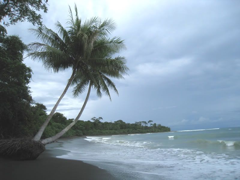
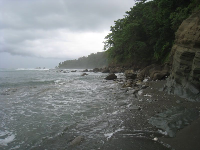
After 10 hours of hiking, we finally reached our lodge. Theoretically you could do it a bit faster, but the muddy trails slowed us down quite a bit. The next morning we ventured out and were greeted with this amazing dark sand beach.
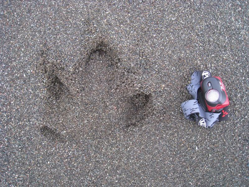
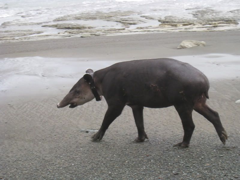
Tracks along the beach, but not a puma. We saw these gigantic tracks throughout the jungle and couldn’t figure out what animal made it. We only knew that it must be a pretty large one.
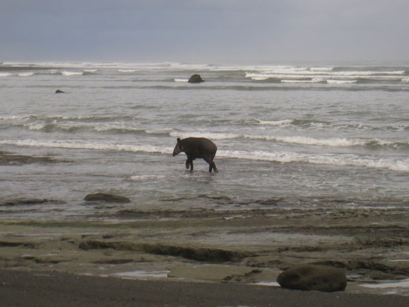
One morning Oliver strolls along the beach following these tracks and suddenly this big animal comes along. This is a tapir! It is on the endangered species list and most people that come to the park are on a mission to see one. It has a radio collar around it’s neck so it can be tracked, but not tame by any means!
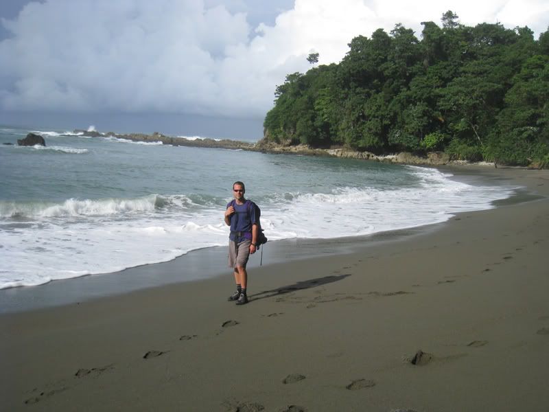
A stroll and a dip in the ocean.
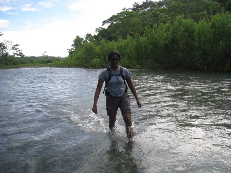
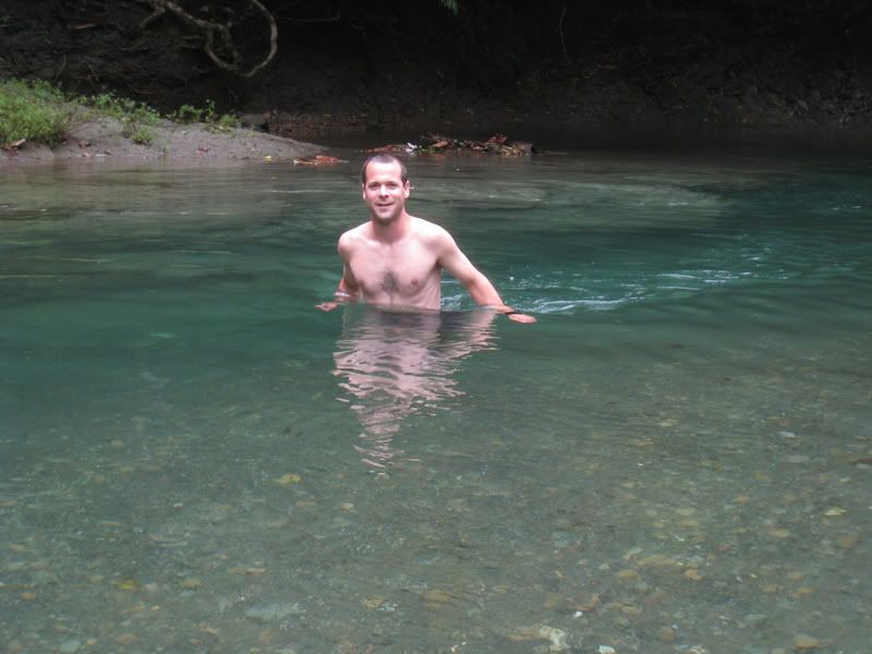
Jaya cooling off in the Rio Clara in Cordova National Park
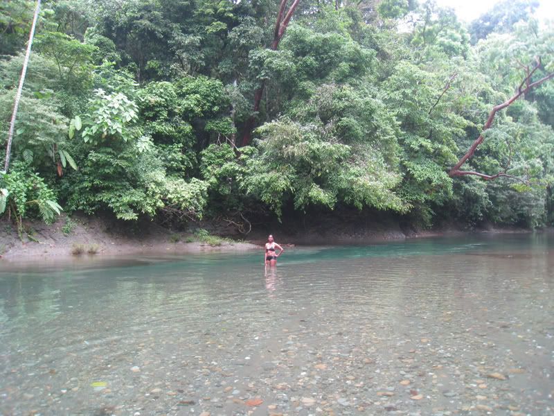
The water was so clear! We actually saw a snake taking a swim in the river but thank goodness it didn’t want to play.
This macaw injured his foot and the staff at the lodge decided to care for it. After his recuperation, he didn’t want to leave. He was a fulltime guest and a very noisy one at that!
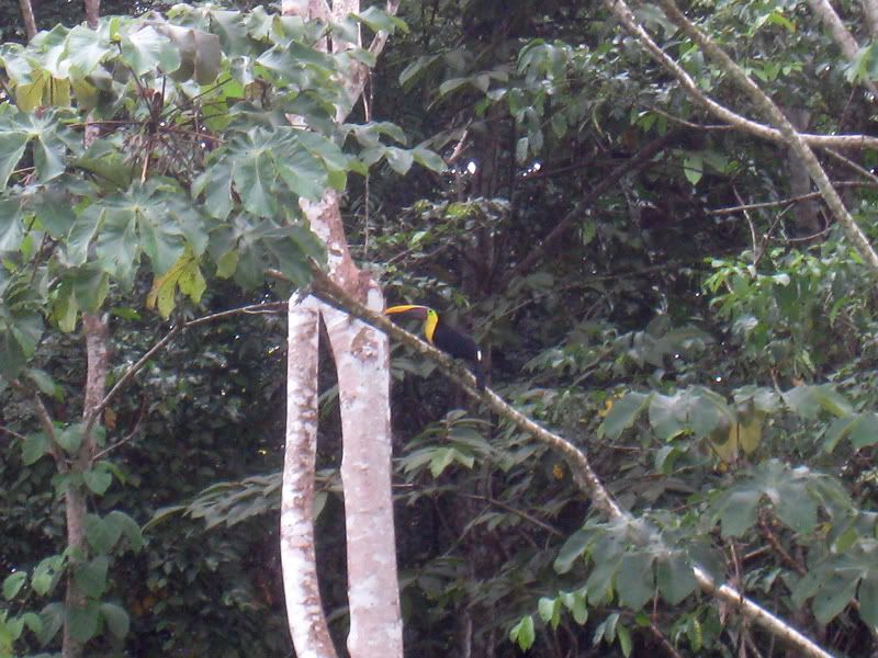
This toucan decided to pay the lodge a visit as well.
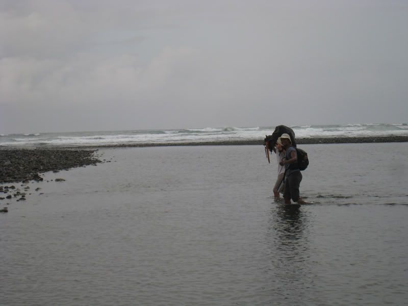
On the third day, we took another trail back to civilization that took us along the beach. We had to check the tide levels and could only cross the rivers during low times. Otherwise there might be crocodiles coming up the river. So here we had to cross yet another river…
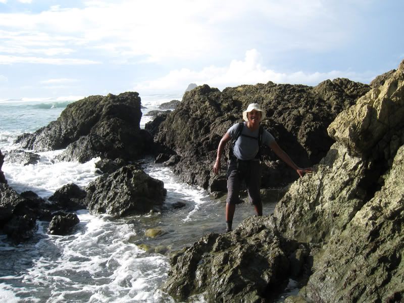
and scramble over rocks during low tide.
This was the last key location we had to pass before the high tide came in. It would not be too pleasant to get smashed against the rocks when the high waves come in.
Picture perfect beach.
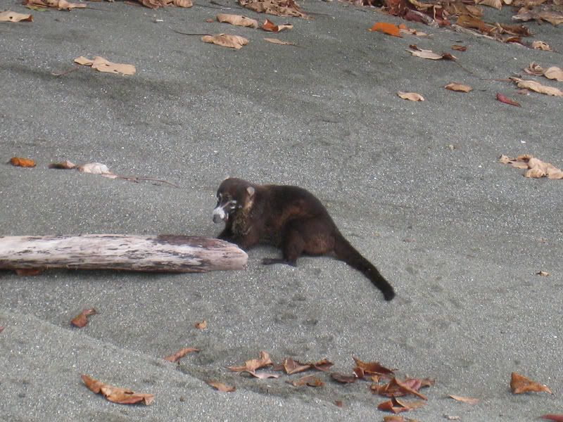
Looks like a racoon? This is a white nosed-coati and they hunt sand crabs. They didn’t seem to mind us taking pictures.
Oliver getting coconuts. We brought water with us, but the sweet coconut water was the best remedy for thirst. I think we “plucked” 12 coconuts on the 7 hour hike back.
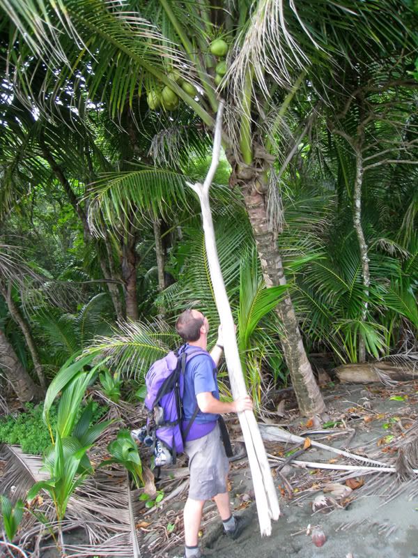
The Swiss army knife came in real handy. It takes a little bit of practice opening up coconuts with a small knife, but Oliver got plenty of practice in the last few months.
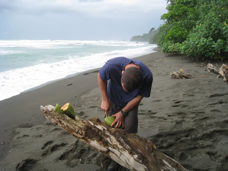
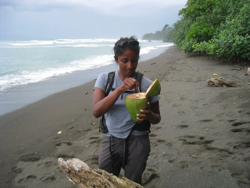
Oh yeah, Oliver brings the knife and Jaya brings the spoon. The sweet jelly of the coconut was so yummy!
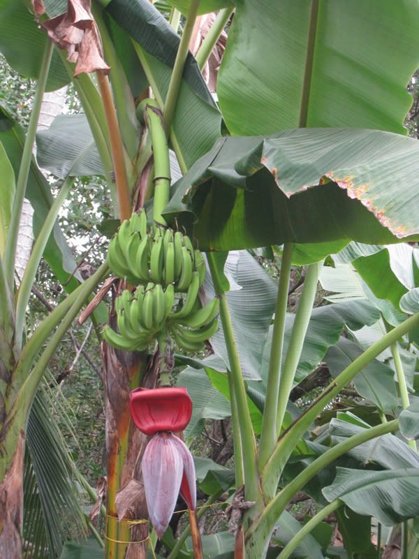
Banana trees along the trail.
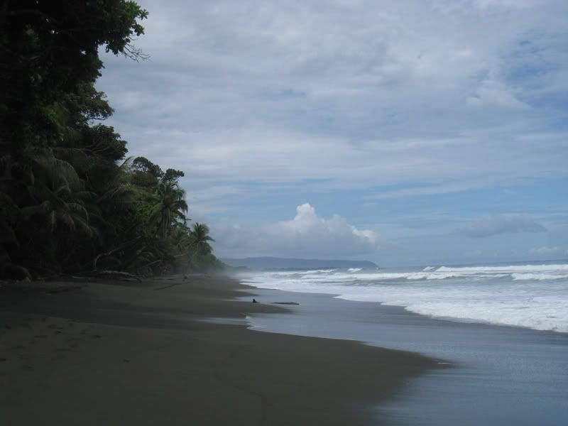
The last few miles of the hike were along this amazing beach. It’s quite stunning when you can walk along the empty beach and the huge waves from the Pacific come crashing down on the shore.
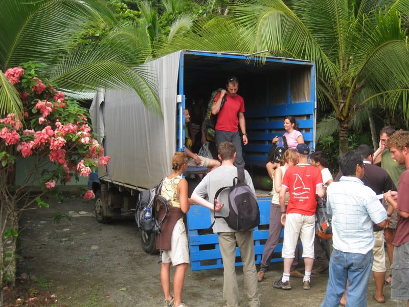
Our “ride” back to the Puerto Jimenez. It’s a collectivo taxi. Everybody just piles in the back of this truck.
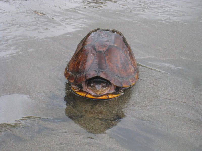
After the Osa Peninsula we went further up the coast to Dominical where Oliver tried out surfing for a few days. He had to opt for the smaller waves though at the beach of Dominicalito. The waves in Dominical itself are just too big and you could easily get hurt if you do not know what you are doing. This turtle is just chilling on the beach.
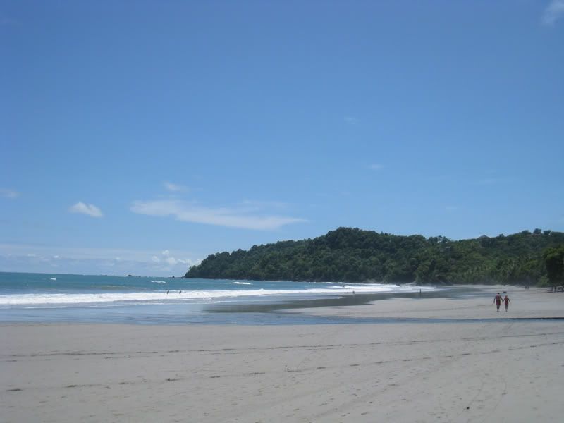
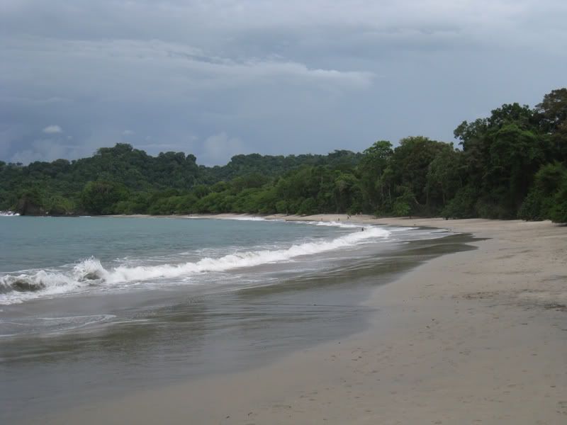
After the surf stop in Dominical, we set off to Manuel Antonio Nationalpark. This was a great place with beautiful sand beaches and a variety of wild animals…
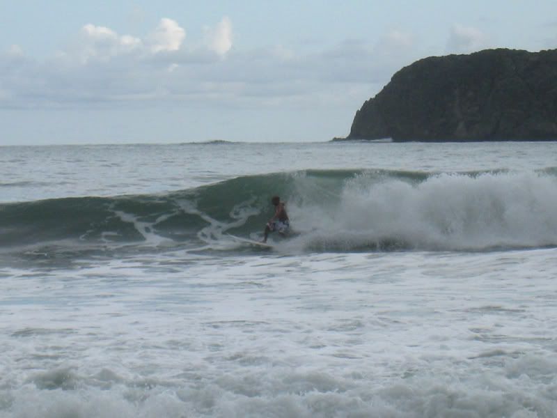
and nice waves.
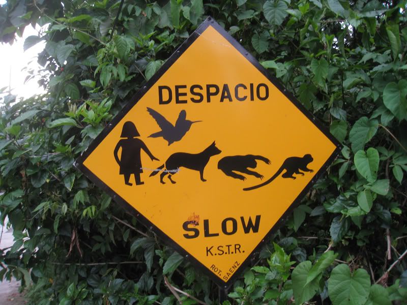
Only in Manuel Antonio will you see a street sign like this! Slow down for sloth and monkeys.
Just hanging out.
This guy was strutting his stuff!
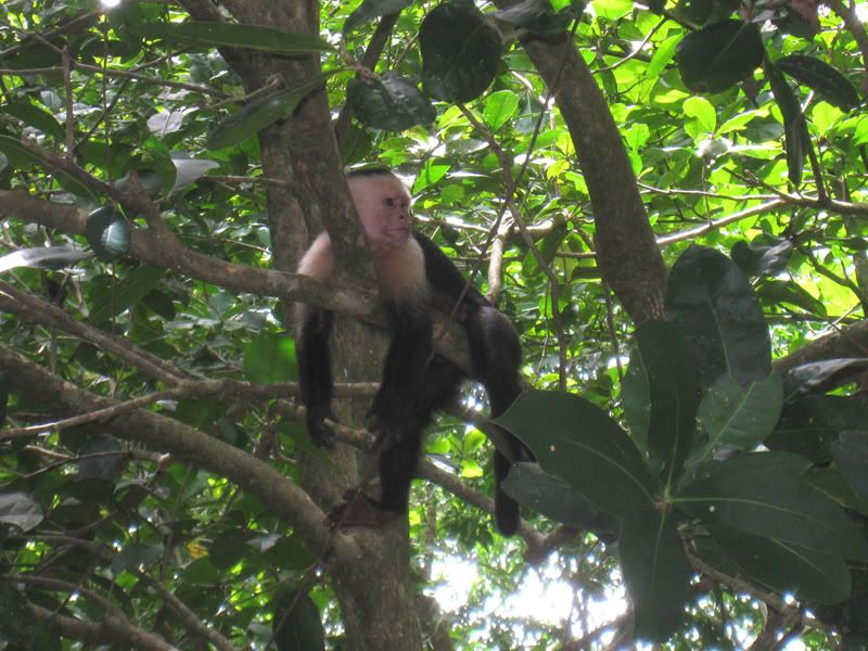
Give me a banana!
It’s kind of hard to make out, but this is a sloth. It was quite easy to take the picture since they move v-e-r-y slow.
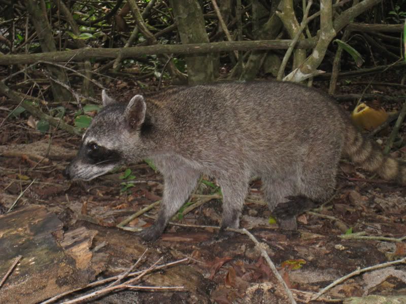
These racoons were everywhere in Manuel Antonio.
Our last beach shot in Costa Rica. The water was clear, warm, and so therapeutic!
However we were quite surprised when we saw a crocodile floating in this water. It’s quite rare, but it happens. But yeah…. after that we did not go in the water at that particular location anymore.
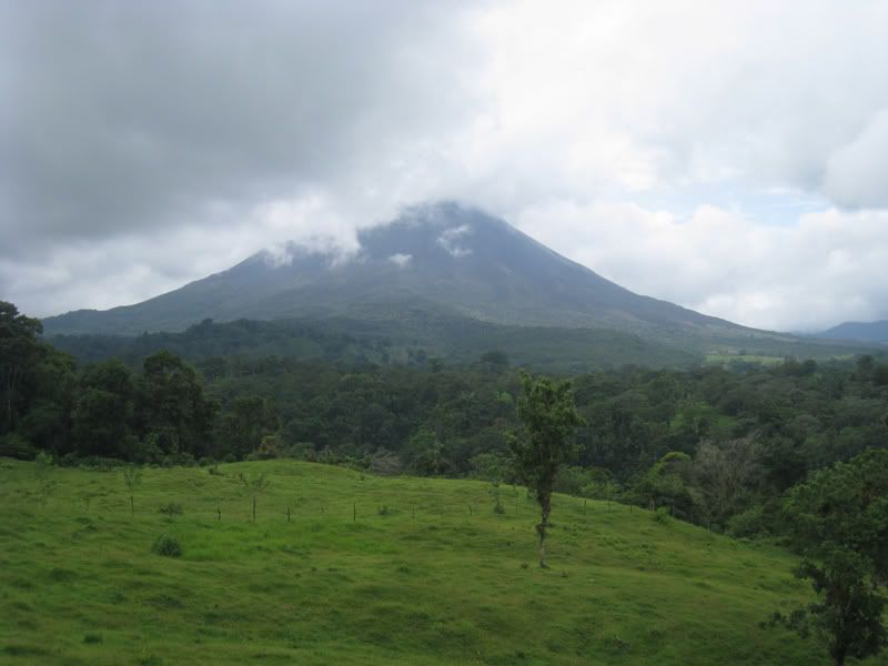
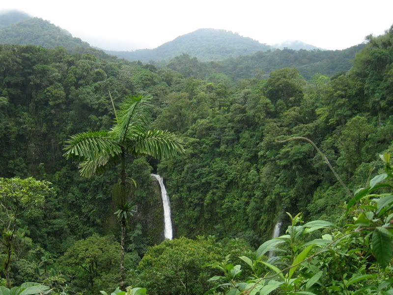
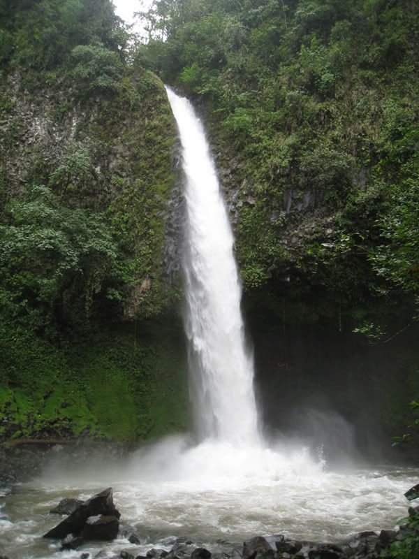
From the Pacific coast we headed inland to see the Volcano Arenal.
We hiked to the base of this waterfall.
The other side of Volcano Arenal. This is an active volcano and at night, you can see the lava coming out. The hot rocks would spew out of the volcano and then come crashing down on the side of the volcano. As the rocks burst open, you saw the red lava. The pictures did not come out too well, but it’s quite impressive. Not as spectacular as it has been in previous years, but still something you won’t see everyday.

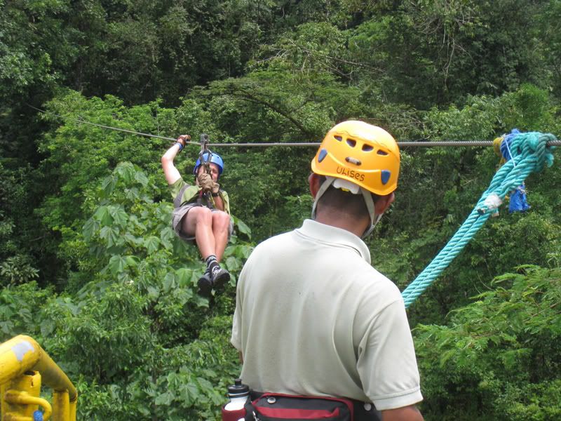
A trip to Costa Rica would not be complete without a zipline tour.
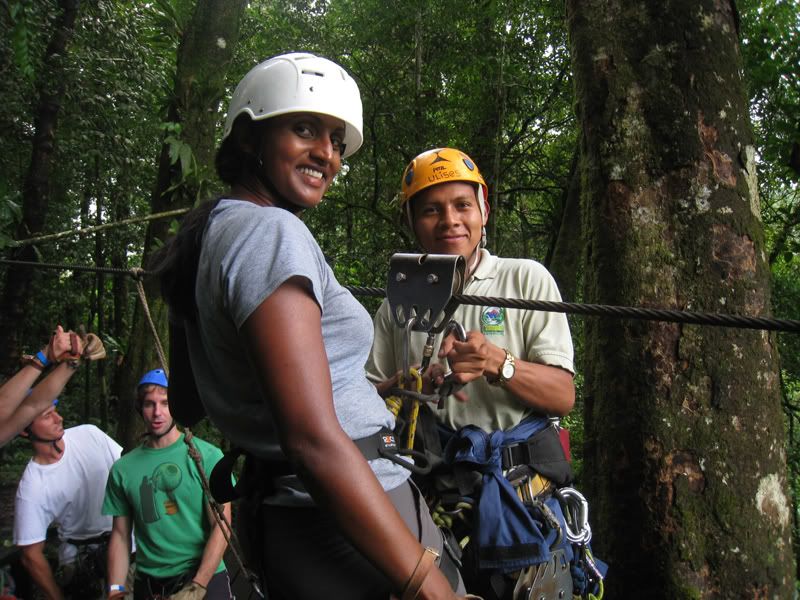
It was exhilarating!
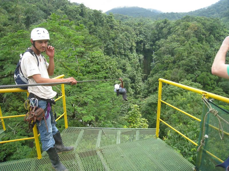
Oliver coming in for the landing
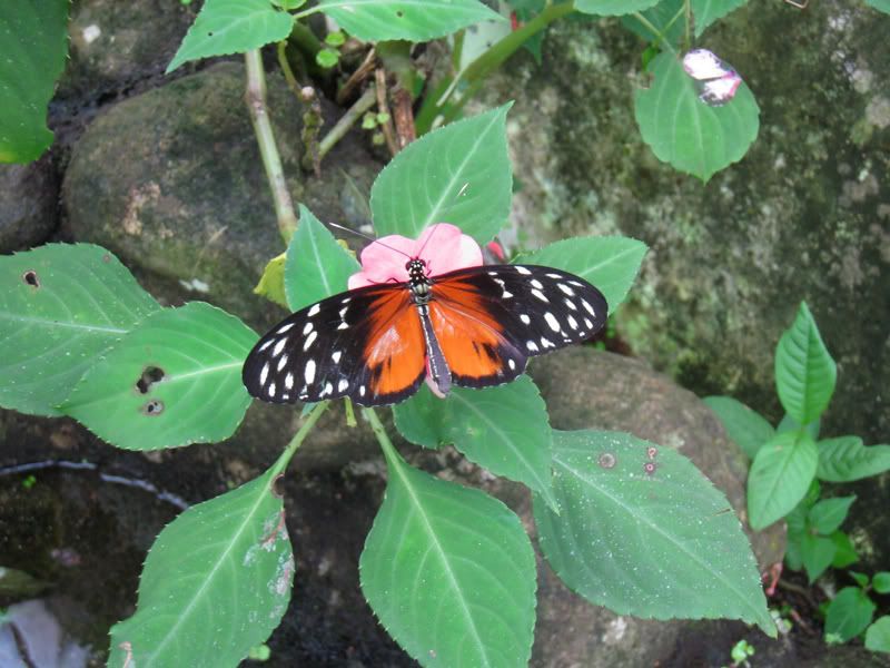
We visited a butterfly sanctuary and the best shot we got was this one. They all were flying around too much!
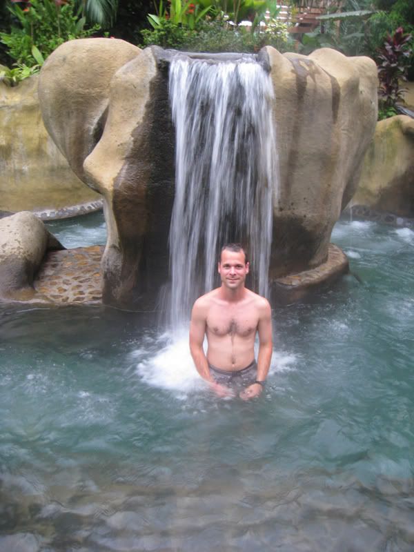
We spent our last night in Costa Rica at Baldi Hotsprings. We had a chance to sit back and reflect on our 6.5 months in South America. However, after 4 hours in hot water we both were looking pretty pruney.
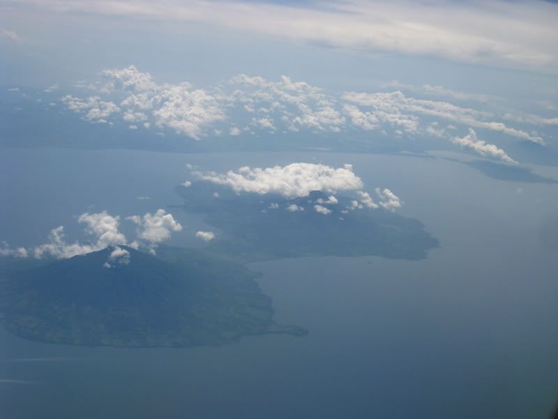
Goodbye Costa Rica
Costa Rica was the last country we visited on our six and a half months journey. Our adventure throughout Latin America was an amazing and unforgettable experience. We visited nine countries, encountered so many different cultures, and tasted an array of different cuisines. It is just slowly sinking in what we actually had accomplished. We travelled over 12,000 miles, crossed the equator 2 times, climbed up to 5,000 meters, and hung out at sea level (uncountable number of times).
We did all this and more over a span of a bit more than half a year. What we have posted on our blog site was just a fraction of what we experienced. We thank you for keeping in tune with our travels and experiences. We still would like to do a summary of all the high and lows, but until then.... hasta luego.
This is a quick view of our total route (more than 12’000 miles):
Best online maps are found under this link: http://maps.live.com/default.aspx?v=2&cp=-18.39623%7E-61.523438&style=r&lvl=3&tilt=-90&dir=0&alt=-1000&cid=2CF1823075161E3B%21106&encType=1 or check the simple Google map below.